Day Two … Christchurch to Twizel (and all the places in between)
Up and on the way just before 8.00 am this morning. Ian had mapped out a drive around central Christchurch to work out where we want to head back to when we return later in our trip. Navigating the one way roads was at times challenging, as well as the times where you couldn’t go directly across an intersection to the other side but instead were forced to turn left.
We then headed out of the CBD, opting to explore the coast, so we headed out to New Brighton a suburb of Christchurch. We had found an Ad Lab that took us to visit five surf life saving clubs along the coast and this gave us a fabulous opportunity to see the beaches at different locations. We also completed an Ad Lab that took us on a short walk through New Brighton itself. Now I think Ian will agree that the beaches are lovely but that New Brighton was a little sad. It is in desperate need of some love by the council as it is looking unkempt and very tatty. So many shops are closed and boarded up which gives it a very dejected feel. We also popped into the library which was built only recently and has stunning views over the beach and the pier but it too looked unloved and just a little “blah”. Our highlight of Brighton was the incredible sand art we found that the artist Webby 23 had obviously completed at low tide.


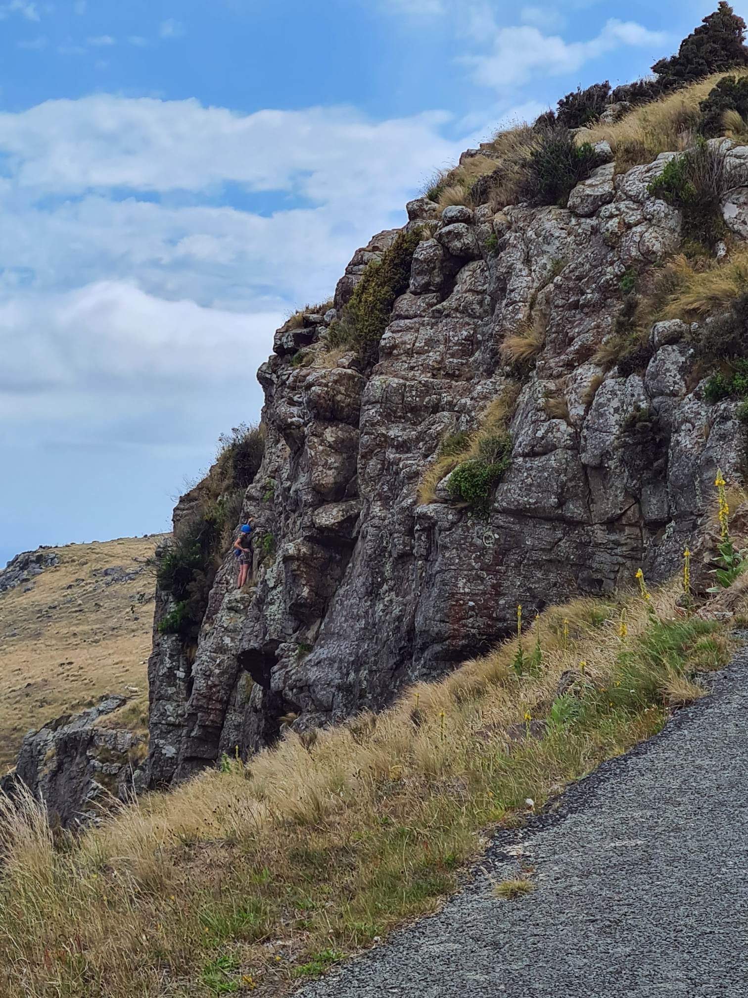
After leaving New Brighton we headed over to Sumner Beach to collect a final Ad Lab as part of the surf life savings series before heading up the mountain along Summit Road. This gives you incredible views back to central Christchurch and the surrounding suburbs. The road itself is set high in the Port Hills and is listed on a website as one of NZ’s most dangerous roads. We found it to be fine, but admittedly a section of the road is now permanently closed following the 2011 earthquakes. The road hugs extinct volcanoes and climbs high into the hills. We were amazed at the hikers and cyclists riding along like they had not a care in the world. At the point where the road is closed there is a walk that takes you to a ridge that allows you to view the township and port of Lyttleton which is where the first four ships from England landed.


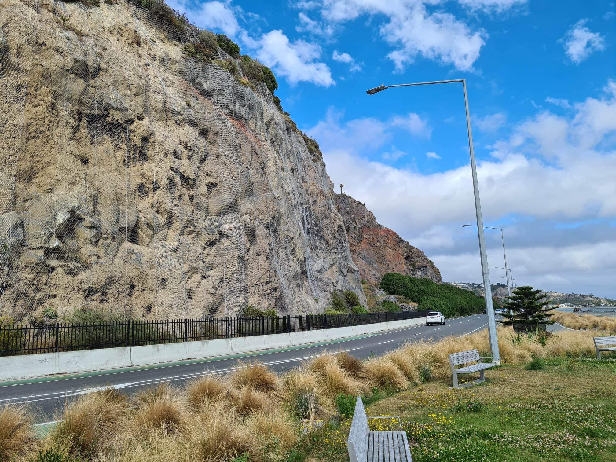


Meandering our way back down Summit Road and detouring onto Sumner Road we had the opportunity to explore Lyttleton. We stopped at scenic lookouts over the ports and watched tonnes of coal being offloaded from a container ship, we visited the Time Ball Station that was used by maritime navigators to adjust their chronometers for accurate map reading, we completed an Ad Lab that took us to many historic sites around the township, paid a quick visit to the very quaint local library before grabbing lunch at a local bakery (yum!) before heading out of the town via the Lyttleton Tunnel that was built in 1965 to connect the port to Christchurch. The road is just over 2 km and is carved into the massive mountains above.


And so we left Christchurch and headed south on our quest of discovery. We stopped at Ashburton (three Ad Labs completed with visits to historic sites, churches, the clock tower, court house, war memorial and a very delightful wander through the Domain Gardens).


Onwards to Geraldine, along the way crossing wide expansive rivers that, whilst fairly dry at the moment, are filled with water when the snow melts at the end of winter. At Geraldine we again did an Ad Lab … this time exploring some of the incredible murals located around the township. We left this beautiful little town with a delicious ice cream in hand and headed off towards Lake Tekapo.


The weather today has been fairly pleasant, a lovely mild 20-25 degrees and with the occasional showers, which luckily for us only happened when we were driving so didn’t impact us very much. While we were driving the mountains were covered in cloud and we couldn’t see much of them. We laughed when we saw a sign for a scenic lookout thinking what on earth could you see and then … we drove over a crest and the clouds lifted and before us were the expansive snow capped mountain peaks in all their glory!


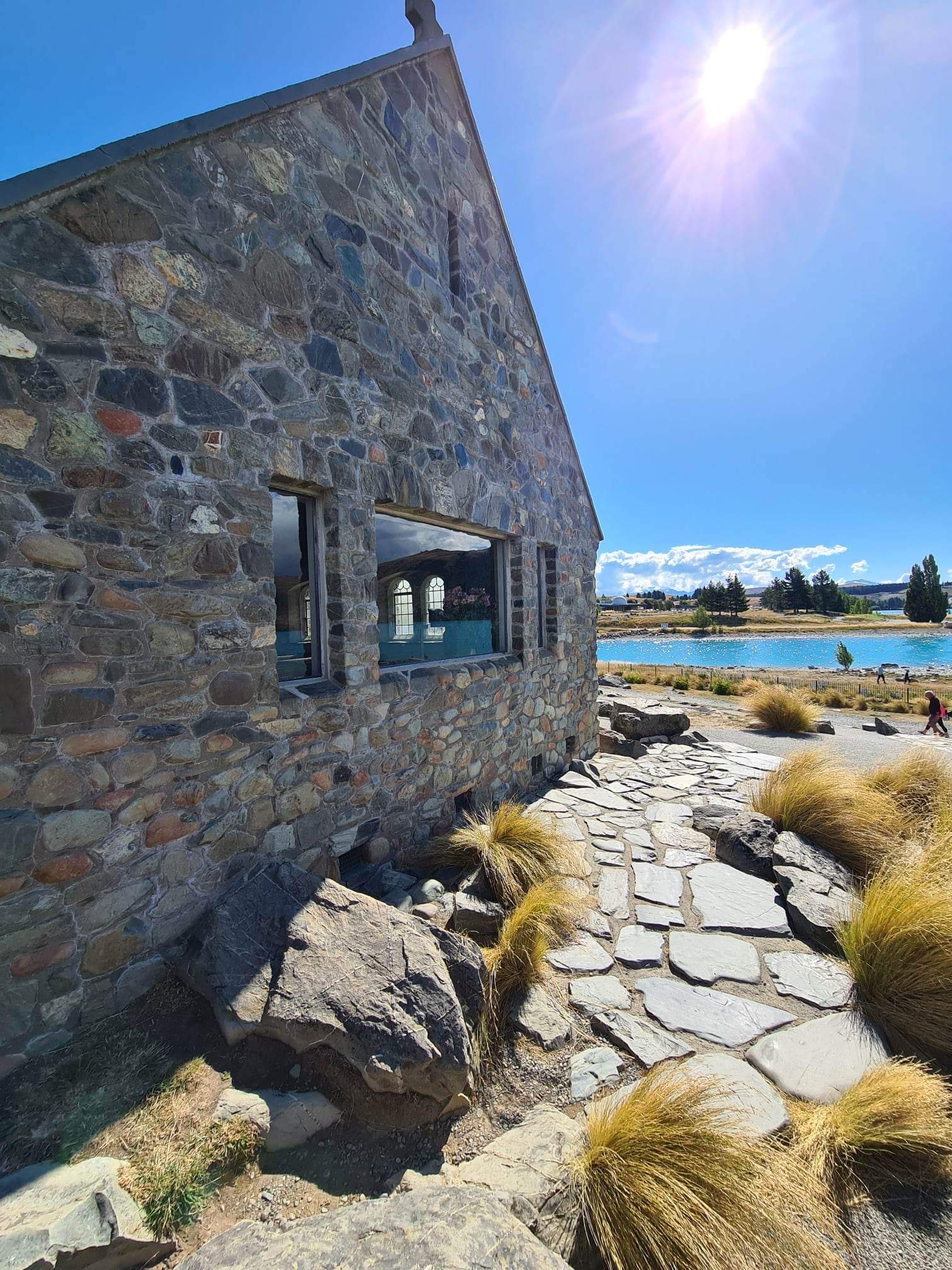
At Lake Tekapo nothing will prepare you for the turquoise water in the lake, the craggy rocks that abut the water and the mountains that rise high above the lake shore. I was stunned, and went a little snap happy with my camera! The statute of cattle dog sitting high in a rocky cairn overlooking the lake is quite amazing and the bluestone Church of the Good Shepherd which was built in 1935 is stunning with the lake in the background.


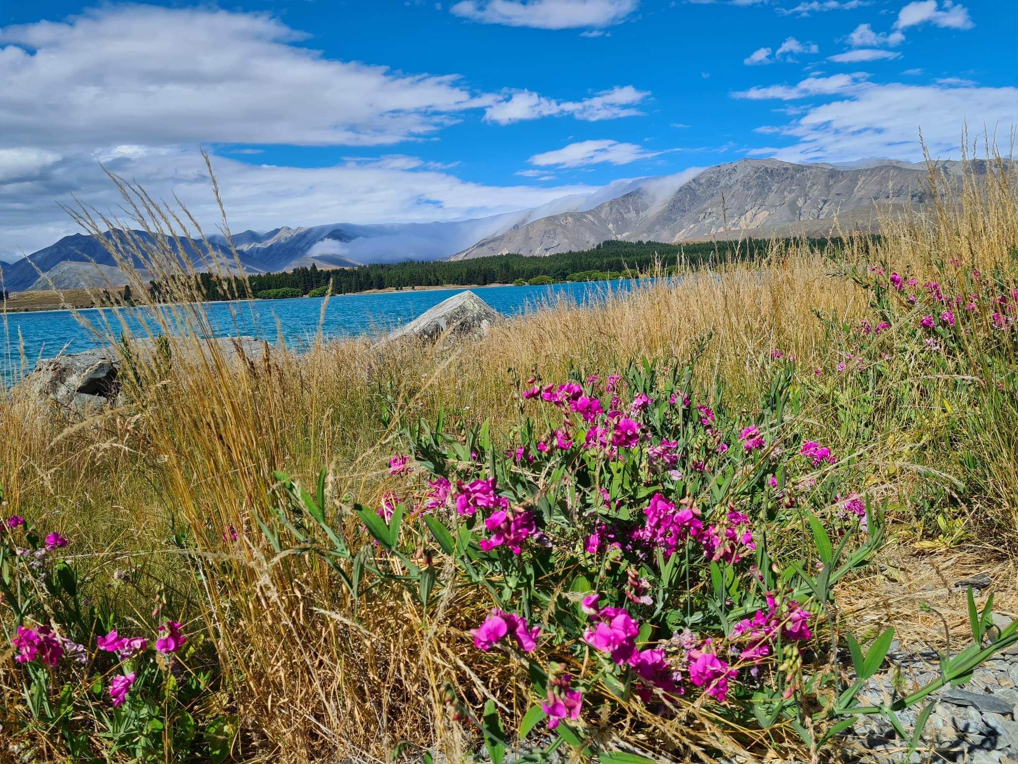

And so, on to Twizel our place of rest for the evening. The drive took us past Lake Pukaki, the largest alpine lake in New Zealand. Again the stunning blue of the lake cannot be described and I am hoping that my photos will do it justice. Rising high above the lake is Mount Cook which the Māori call Aoraki, the tallest mountain in all of New Zealand. We arrived in to Twizel just after 6.00 pm, checked in, dumped our bags, headed out to complete an Ad Lab to learn more about this little town before heading to dinner.


Back at our accomodation and we are doing what we do … I’m writing the blog and Ian is planning the day to come.
Today’s tally …
Photos … 450
Steps walked … 16,377
Kms walked … 12.5 km
Ad Labs completed … 8

Oh my goodness such beauty! That water!! And I'm so glad you had ice cream! :) I have to laugh every time you say CBD though because it means a very different thing in the US! ;)
ReplyDeleteWhat is an Ad lab?
ReplyDelete