Day Seventeen … An adventure in two parts
Today’s blog will be written in two parts. The morning written by Jacqui … and the afternoon featuring Ian. The day has been huge, and we have been on the go for almost 12 hours, so it will take two of us to write it. As I write this opening paragraph Ian has gone out to forage dinner for us. It is 7.16 pm and we have just checked in to our accomodation … but more on that later.
Morning adventures …
We woke early this morning … having set an alarm for 7.00 with the aim of being on the road by 7.30 we were actually up, dressed, packed and out the door before we had anticipated. Given the quality of my morning coffee yesterday in Ross we stopped at McDonalds for a drive through before we hit the road. There was one staff member working. She was taking the drive through orders, cooking the food and making the coffee … but was still more efficient than some of the drive through we have used before (we are looking at you Maccas on the Western Ring Road).

Our coastal drive this morning was glorious. It was probably a good thing we left early because poor Ian had to stop all the time for me to take photos. The sea north of Greymouth is vicious and wild, pounding the coast creating plumes of sea spray, crags of rocks and incredible wow moments as you drive along. Whilst our drive to our northern most point today was less than 50 kms it was one filled with wonder.


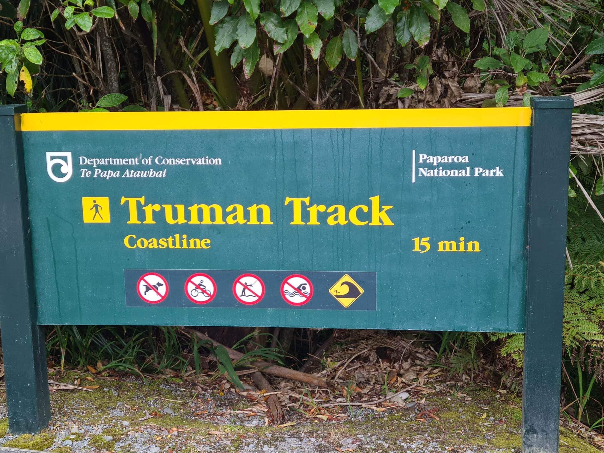
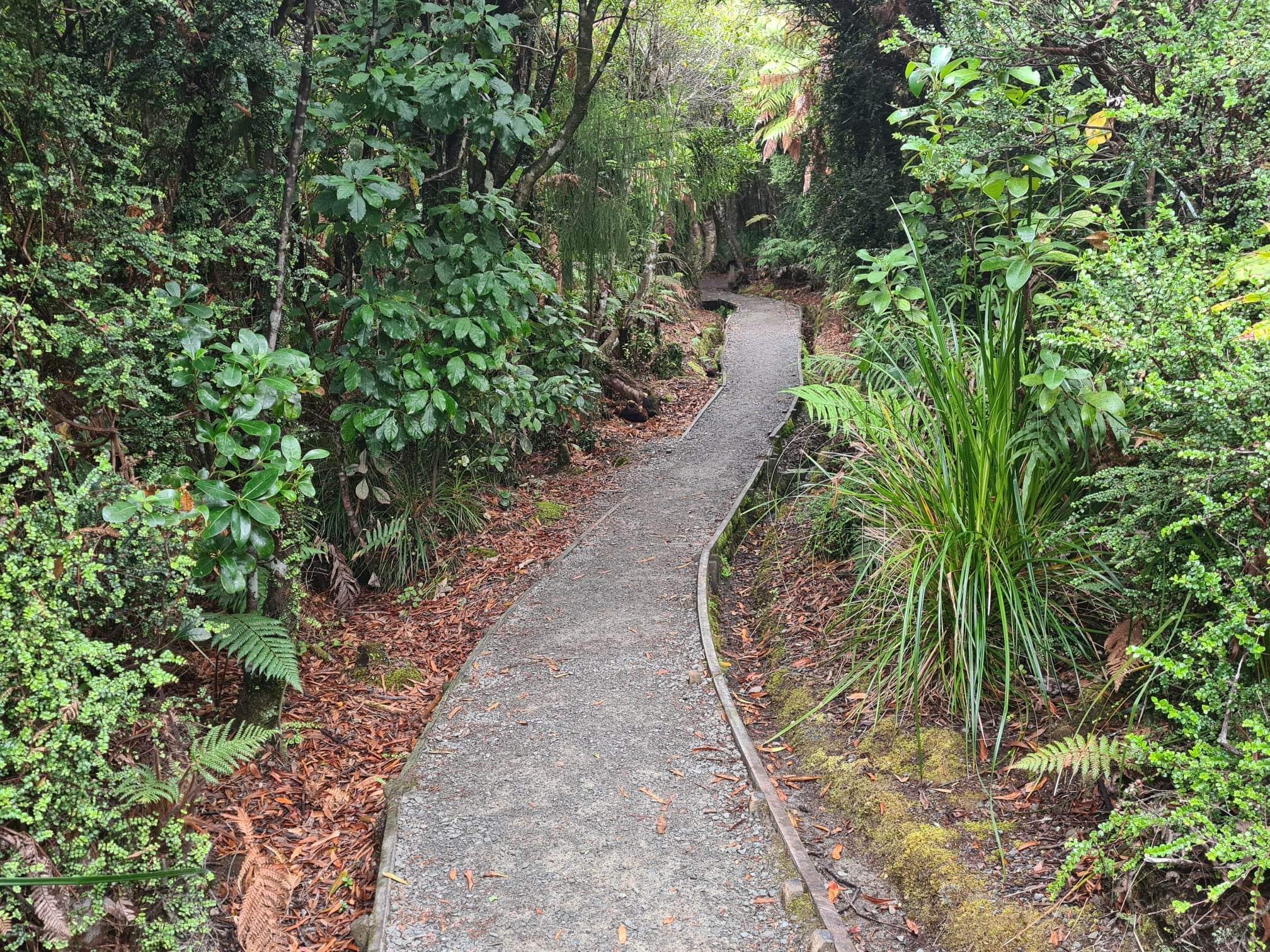
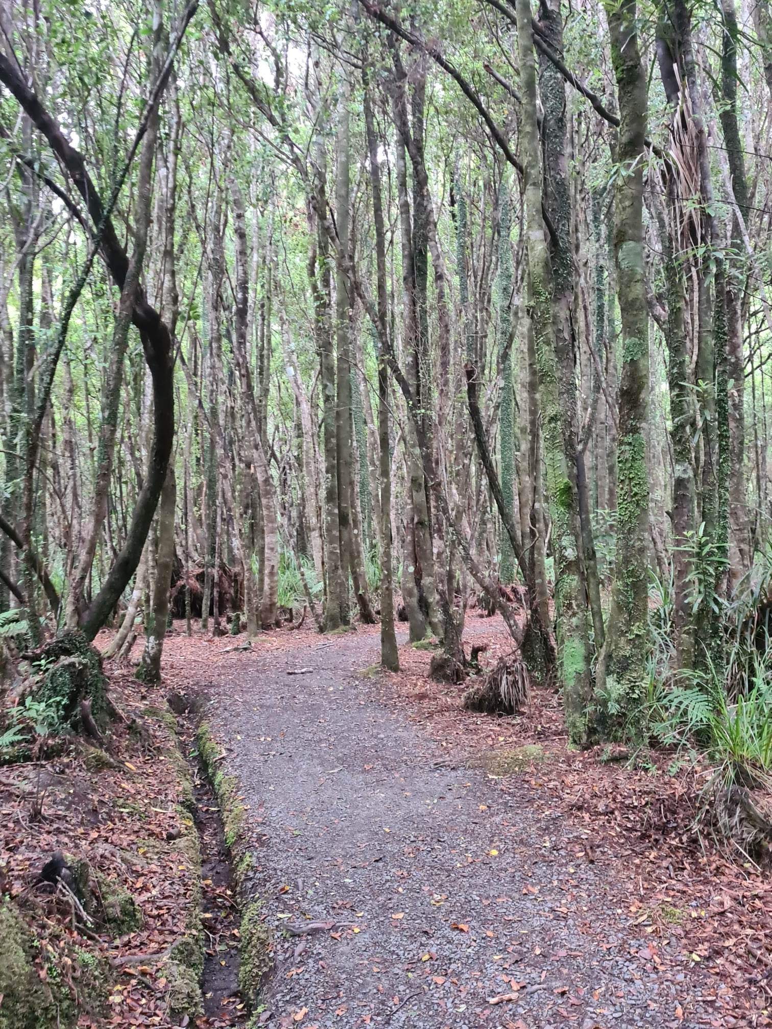
Our first “official” stop was the Irimahuwhero Lookout where we stopped to look out over the beating Tasman Sea. The views there were nice but many of the stops we had already had along the highway were even better. We grabbed some photos and then headed back to the Truman Track. This track is just a pull in off the highway with a tiny place to park. The walk is a 30 minute return which takes you in to the coast. As you walk you pass through at least four different environments … forest, then a different type of tree scape, grassland and finally the rocky sea and the craggy cliffs. It was so different as you walked along. We passed a weka scampering across the path as well. The coast was beautiful and rugged. Such an enjoyable walk even when I face planted onto the path as I stumbled up the stairs returning to the car (what’s a few more bruises).


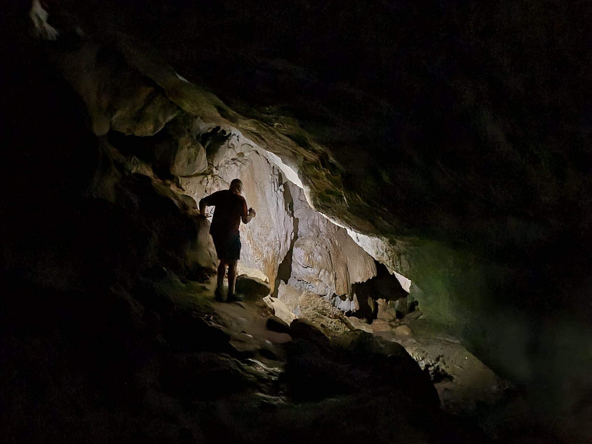
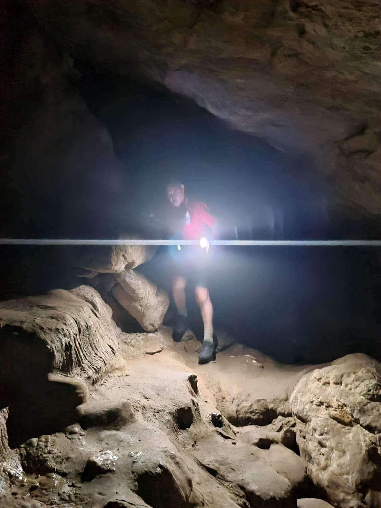
We then headed to the next stop on our itinerary … Punakaiki Cavern. This is a stop that I think almost 98% of travellers would miss, firstly because it is not signposted very well, and secondly most would never consider scrambling through a cave. Not us though, with phones in hand for torches we crossed the highway and took the stairs into the cavern. Once inside it was torches on and slow and steady, making sure your foot was stable, walkjng (often hunched over) into the depths of the cave. As you crept in you could hear the water dripping from the ceiling, see the stalactites forming on the overhangs right beside you and walk beside small trickles of water. It was an absolute adventure. We have been caving before but only ever on guided tours with walkways, lighting, chains to hold on to and someone to point things out to you. This was free … you discovered … you decided where to go, how far, where to walk. It was beautiful, it was serene and it was exhilarating.


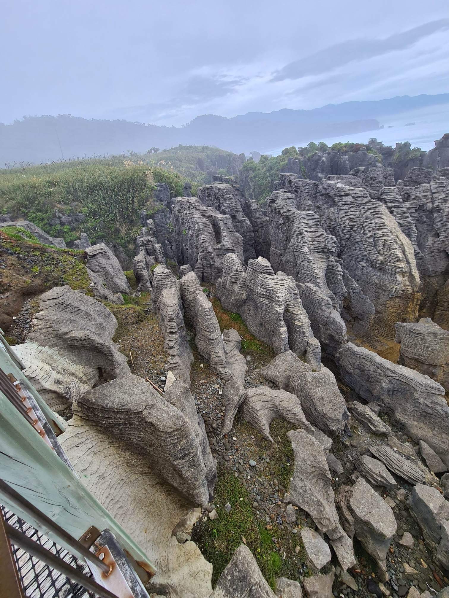
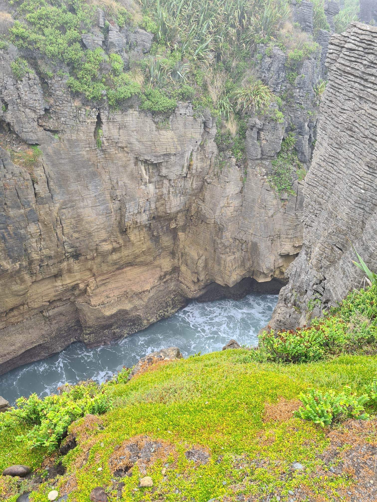
Leaving the cavern we headed to the more well known tourist location … Punakaiki Pancake Rocks and Blowholes. We arrived at exactly the same time as a large bus group so decided to do the walk in reverse to beat the crowd. The limestone rocks that rise out of the sea have been weathered and eroded by the sea and wind to look like stacks of pancakes. Some are close to collapse (who knows when), others are tall and imposing. In some areas the sea has eroded beneath the rocks so that you are walking on a path that has wild ocean crashing beneath you. Again the sea was ferocious and the water rising into the rocks and crashing against them causes massive wave crashes and spouting blowholes as the pressure of the water rushes to escape. It was stunning to stand there and hear the landing waves, the roar of the blowhole and feel the spray of the water. We encountered a drizzly rain as we walked but with the water from the blowholes one way or another you were going to get wet. We completed an Ad Lab as we walked around which gave us more information about the location as well.


By 10.30 we had completed everything that Ian had thought we would be able to get done before we needed to head back to Greymouth so it was time to go off on an additional adventure. Grabbing a coffee to go we headed back towards Greymouth having found an Ad Lab in an out of the way old town some 25 minutes out of Greymouth. So we drove to Blackball … an old coal mining town, and boy was it an oddball. The five clues took us to the old coal mine, the local swimming pool (originally dug by the miners in their ‘down time’, the public conveniences, the community hall and the museum (which was 2 shipping containers with some information boards on them). We learnt about the first miners strike which led to the formation of the NZ Labour Party, we saw the Blackball Salami Shop and we saw some very, very sad houses!


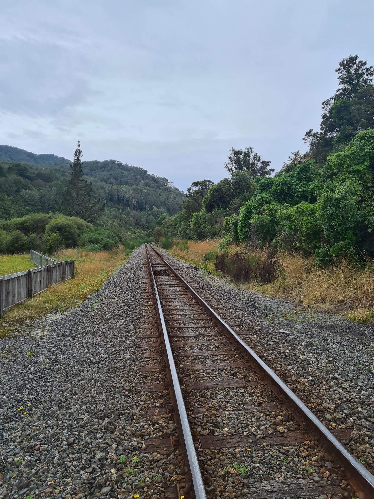
Driving back to Greymouth we stopped for me to take photos of the Brunner Bridge, an old railway bridge built to service the coal mine. When I jumped back in the car Ian told me that there was another Ad Lab there and given we thought we could speed Ad Lab to grab the five clues we jumped out of the car and headed off in search of coal tunnels, brick works and chimney stacks. It was fun … we passed people ambling along as we were searching for clues … just how big was Brunner Mine after all. Another great experience in a place we would not have explored and a little more knowledge about the coal mining industry and the hardships and disasters it entailed.


Afternoon adventure
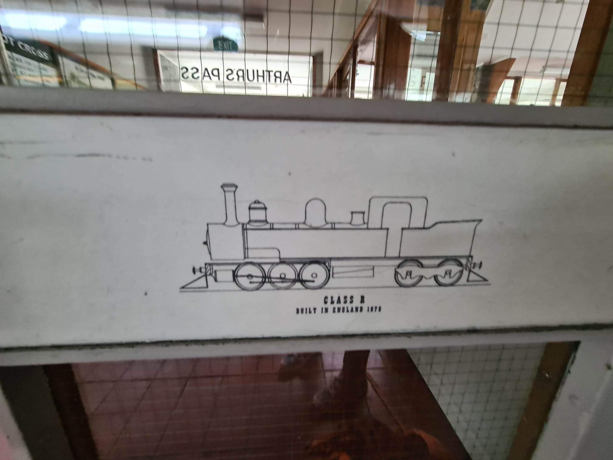
Ian here on the afternoon shift. … With all our morning adventures we still managed to drop off the hire car, pick up our train tickets and grab a sandwich lunch on schedule. Then it was time to wait for our big adventure … the Tranzalpine train from Greymouth to Christchurch. Rated as one of the great rail journeys of the world the 5 hour train ride takes you from coast to coast across NZ’s South Island, starting beside the Tasman Sea at Greymouth, rising up into and through the Southern Alps, down across the Canterbury Plains and ending back at sea level on the Pacific Coast.


Please note - the following words and pictures won’t do it justice. This train ride is an experience! Not only are you in airline type seats with armrests, headrests and LOTS of legroom, the windows are massive so you have clear vision on both sides. AND there is commentary through your personal headset for about 2 of the 5 hours in little 4-8 minute bursts, covering scenery, history, culture, etc. Awesome!
The first stage of the journey took us along the Grey River, through old coal and gold mining country, including a sweep past the Brunner Mine site exactly where we had been 2 hours earlier (at the time we thought we were just walking across some old mining rail tracks, not a functioning rail corridor). We passed rivers, dams, lakes, fields, hamlets and more. Jacqui and I spent a bit of this leg in the open air viewing carriage at the rear of the train - closer to everything, almost able to touch the walls of the tunnel we passed through, and feeling the wind in your hair.


The second stage took us to Arthur’s Pass, the high point of the trip (literally). The route meanders up valleys, taking this one, then that, and around that corner, slowly gaining elevation. A motorbike rider who had friends on the train kept us company, matching his speed on the highway to ours on the track, waving back as we waved at him. Upward, upward until you reach the Otari Tunnel, 8.5km of blackness - so I caught a few zzzzzs.


Stage 3 descends from Arthur’s Pass through similar valleys on the eastern side of the alps. The braided rivers are unbelievably wide and must be amazing in mid Spring as the winter rains come down off the mountains.
Stage 4 takes you alongside the Waimakariri River for about 40 minutes. There is a deep gorge on one side of the tracks, through which runs the milky turquoise blue river. I mean steep, don’t look down stuff. Then you pass through 8-10 short tunnels. The gorge is so steep (did I mention that) there was nowhere else to go but through the hills. And the commentary gleefully tells you of the dangers experienced by the brave men who built the railway.


Finally, you work your way across the rich pastoral lands of the Canterbury Plains. Cattle, sheep, crops, highly productive milk factories, quirky little towns. And before you know it you are at Christchurch Station. Where … you meet a friendly cab driver who will feature in tomorrow’s epic adventure. But that is tomorrow. For now we are fed, showered and ready to relax after another wonderful day.


Today’s tally …
Photos taken … 506
Steps walked … 12, 846
Kms walked … 9.66 km
Ad labs completed … 3
Comments
Post a Comment